Very high resolution (VHR) satellite images provide a mass of detailed information which can be used for urban planning, mapping, security issues, or environmental monitoring. Nevertheless, the processing of this kind of image is timeconsuming, and extracting the needed information from among the huge quantity of data is a real challenge. For some applications such as natural disaster prevention and monitoring (typhoon, flood, bushfire, etc.), the use of fast and effective processing methods is demanded. Furthermore, such methods should be selective in order to extract only the information required to allow an efficient interpretation. For this purpose, we propose a texture region segmentation method using the level set algorithm and the multi-kernel theory. We design a selective and local multi-kernel stop function for which the regularization term depends on the fuzzy membership degree of a given pixel to be on the boundary or not. Favored by its local nature, the method is accelerated by means of an NVIDIA graphics processing unit programming. The new algorithm is selective, effective, and fast. Experimental results on VHR satellite images demonstrate subjectively and objectively the effectiveness of the proposed method.
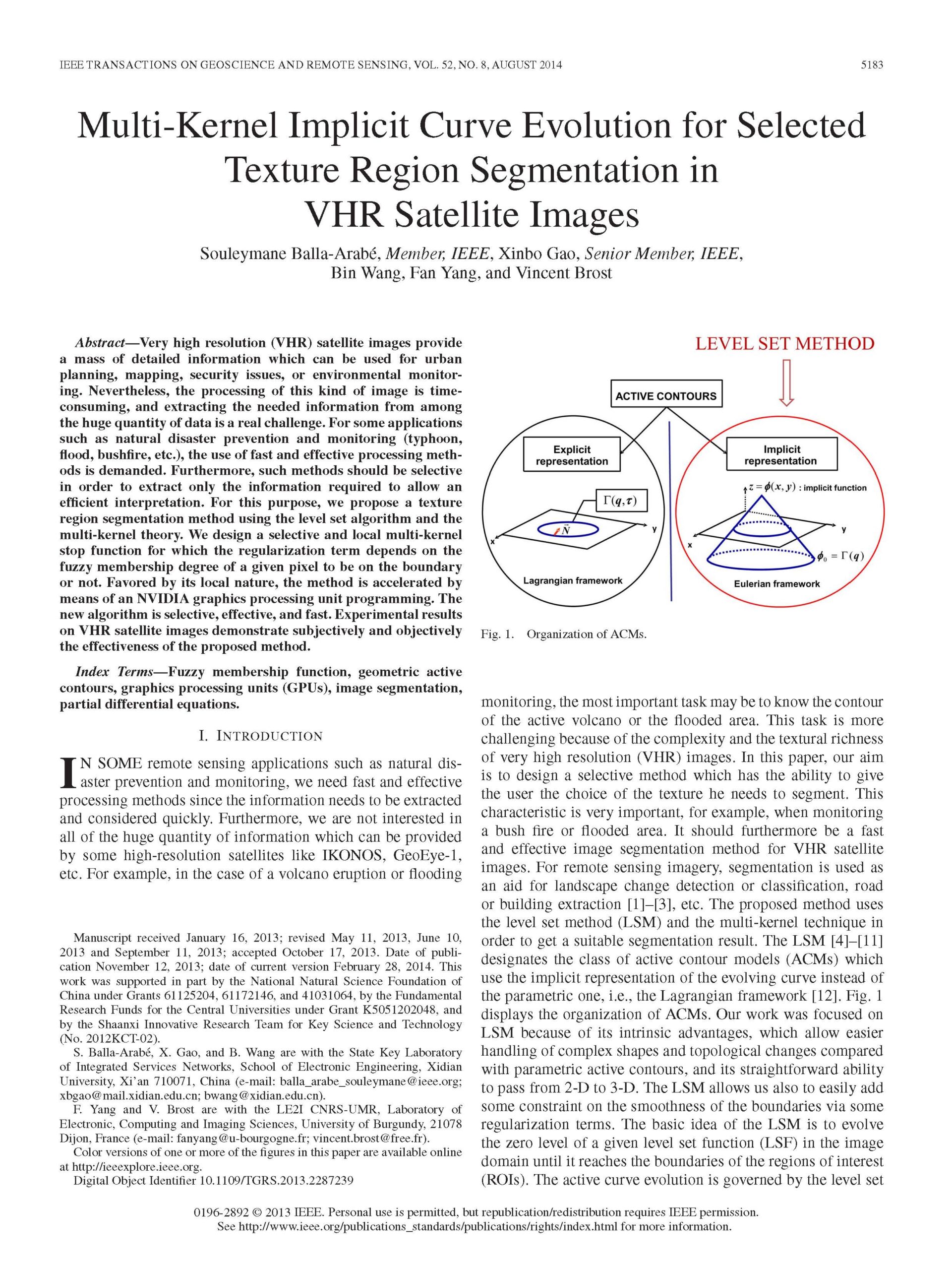
Multi-kernel implicit curve evolution for selected texture region segmentation in VHR satellite images